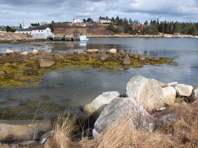
The bouys just off the coast of Nova Scotia, in the region around Georges Bank, are picking up some amazing numbers: including a nearly 40 foot wave height. Holy smoke....hold onto your hats.

 Notice that the wind speed graph doesn't go higher than 70 knots....
Notice that the wind speed graph doesn't go higher than 70 knots.... The track is shifting to the east again, which means a potentially greater impact for Nova Scotia than had originally been discussed on a variety of hurricane sites. There are several warnings issued for regions of Nova Scotia, including Halifax. I wouldn't underestimate this storm: the satellites look impressive, bouys in Georges Bank are recording winds of 130 km per hour and the system is getting very close to land. I am hoping for minimal damage along the southern shore but worried that it may be bad when this storm passes. Time will tell. In the meantime, pay attention to the National Hurricane Centre, Canadian Hurricane Centre and Wunderground....times like this I wish that the CHC updated more frequently!
Interesting post about Kyle from the Weather Network
0 Comments Published by CBEMN on Saturday, September 27, 2008 at 7:23 AM.
"While Kyle's eventual impact is still unclear, this is an important storm that needs to be taken seriously. Setting aside the meteorology for a second, the parallels with Juan are eerie. Both Kyle and Juan formed on Thursday September 25, and Kyle looks to make its impact during Sunday night, at almost exactly the same time that Hurricane Juan made landfall just west of Halifax.
However, in meteorology, we look at facts, not coincidence. There are similarities between the two storms. Both Juan and Kyle are taking similar tracks moving due north from a position near Bermuda (Juan went east of Bermuda and Kyle is passing to the west). Kyle has the opportunity to strengthen before it hits the cold waters north of the Gulf Stream, just as Juan did 5 years ago.
While the tracks look vaguely similar, there are important differences. The current thinking is that Kyle will have its worst impact in southwestern Nova Scotia and possibly southwestern New Brunswick depending on the exact track Sunday night. Juan had a track that maximized damage in a heavily populated corridor from Halifax to Truro to Charlottetown. Also, even if Kyle continues to strengthen through today and tonight, it will have to move over the chilly water south of Shelburne, NS (blue shading in the picture below) that is 3 degrees cooler than when Juan hit 5 years ago. Tropical cyclones crave heat and moisture, so cooler water is good news for us.
However, the threat with this storm is real and like any tropical system, we are concerned about two impacts - wind and rain. Rainfall is ongoing across sections of the Maritimes today as a frontal system will put down locally heavy amounts through tonight well ahead of Kyle. At this point, it looks like New England has a much better chance of seeing flooding issues related to these systems as opposed to the Maritimes, but western New Brunswick and the Gaspe Pennisula of Quebec may see enough rain through the weekend to cause problems.
Wind is potentially the bigger story. Nobody remembers Juan for its rain, and the danger with Kyle is that this storm strengthens further today and tonight and loses only a little intensity prior to making a landfall Sunday night. The debate about whether Kyle is tropical or not at landfall is moot if the storm is producing wind gusts of 100 to 120 km/h, which is certainly possible just east of its landfall location (best chance for this appears to be in southwestern Nova Scotia based on the current track). With leaves still on deciduous trees, winds of this strength will bring down many trees and cause widespread power outages.
While the current forecast suggests Kyle will not measure up to Juan, this is still a storm that could do significant damage in sections of the Maritimes. I covered Hurricane Juan the night it made landfall in Nova Scotia, and while Kyle may not look as bad at this point, this is the first storm that has looked somewhat similar to that terrible blast of wind 5 years ago this weekend."
Brett Anderson at Accuweather has posted his forecast of potential impacts from Kyle. I follow Brett's blog regularly and his skills are quite accurate. So his prognosis for the Atlantic coast worries me:
http://www.accuweather.com/mt-news-blogs.asp?partner=accuweather&blog=anderson
http://www.accuweather.com/mt-news-blogs.asp?partner=accuweather&blog=anderson
So it looks like Sunday is bring "Kyle"
0 Comments Published by CBEMN on Thursday, September 25, 2008 at 5:11 PM.
Let's see what Sunday brings.
0 Comments Published by CBEMN on Wednesday, September 24, 2008 at 4:44 PM. Some long-range models have the current disturbance off the Carolinas developing into a storm event that could track up Nova Scotia by Sunday. Let's see what this develops into.
There's not much more to be added to what the Canadian Hurricane Centre has been updating. I will post more as this continues to track closer to Nova Scotia tomorrow.
Environment Canada's Hurricane Centre issues this statement this afternoon:
TROPICAL STORM HANNA INFORMATION STATEMENT ISSUED BY THE CANADIAN HURRICANE CENTRE OF ENVIRONMENT CANADA AT 3.00 PM ADT WEDNESDAY03 SEPTEMBER 2008.
THIS IS A PRELIMINARY INFORMATION STATEMENT REGARDING POSSIBLE FUTURE EFFECT OF HANNA ON ATLANTIC CANADA. REGULAR MESSAGING IS PLANNED TO BEGIN AT 9.00 AM ADT THURSDAY 04 SEPTEMBER.WE ARE MONITORING THE DEVELOPMENT AND MOTION OF TROPICAL STORM HANNA OVER THE BAHAMAS. MOST COMPUTER MODELS SHOW THE STORM REGAINING HURRICANE STRENGTH AS IT MOVES NORTHWESTWARD TOWARD THE SOUTHEASTERN U.S. THE MODELS ARE ALSO SUGGESTING THAT THE REMAINS OF THE STORM COULD MOVE NORTHEASTWARD TOWARD EASTERN CANADA SOMETIME DURING THEUPCOMING WEEKEND..BRINGING WIND AND RAIN. IT WON'T BE UNTIL LATE THURSDAY OR FRIDAY BEFORE WE HAVE MORE SPECIFICS ON HOW THE SYSTEM MIGHT AFFECT THE REGION. THIS MESSAGE SIMPLY SERVES AS A HEADS-UP TOTHE POTENTIAL ROLE OF HANNA IN OUR FUTURE WEATHER..AND TO INFORM THAT THE CANADIAN HURRICANE CENTRE WILL BE WATCHING THE SYSTEM CLOSELY.END FOGARTY/BOWYER

 The system will likely pass late Saturday night/early Sunday morning across Nova Scotia as a tropical or extratropical storm. The tracking across land masses, and the entry into higher latitudes and cooler sea surface temperatures should ensure that it does not develop into a hurricane but this should not diminish how seriously we should take weather systems like this. Some of our worst rain events have been from lesser storm intensities. There will be more to report on this system in the days to come.