
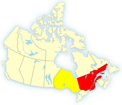
Thunderstorm Watches and Warnings in parts of Saskatchewan, Manitoba, Ontario, Quebec and New Brunswick
 Warnings
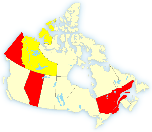
Beaver Creek 3.10 PM PDT Tuesday 27 June 2006Rainfall warning forBeaver Creek continued 25 to 35 millimetres are expected in these areas by this evening.
Watches
Thebacha Region including Ft. Smith - Salt River Reserve 6:10 PM MDT Tuesday 27 June 2006 Severe thunderstorm watch for Thebacha Region including Ft. Smith - Salt River Reserve continued Severe thunderstorms are possible early this evening.This is an alert to the potential development of severe thunderstorms with large hail and damaging winds.Monitor weather conditions..Listen for updated statements. If threatening weather approaches take immediate safety precautions.
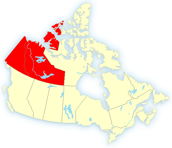
All of central Alberta under a severe thunderstorm watch or warning.
Warnings
Laurentians5:44 PM EDT Tuesday 27 June 2006Rainfall warning forLaurentians continued A first band of precipitation has left about 20 mm of rain on theabove areas this morning. A second band will move through theseregions later today and overnight. 30 to 50 mm are expected as itdoes.
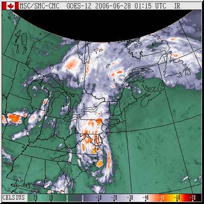
This is the system going through southern Quebec now, with the central low off the Carolinas. It has caused flooding in parts of the U.S., including Washington. It will be passing Nova Scotia by Friday. This June has been extremely wet. Records may have been set.
Freezing Rain Warning in late June in the Canadian North
0 Comments Published by CBEMN on Friday, June 23, 2006 at 4:53 AM.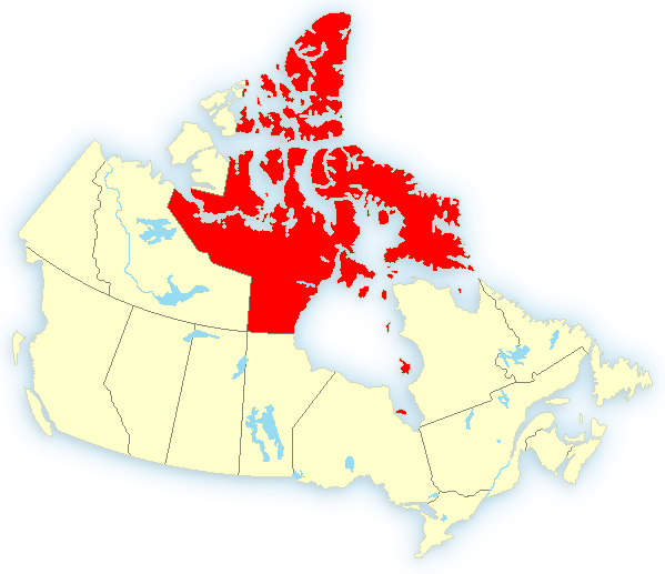 Coral Harbour 3:28 AM CDT Friday 23 June 2006 Wind warning for Coral Harbour issued Strong winds of 60 gusting 80 km/h are expected to develop early this morning and persist until evening.This is a warning that damaging winds are imminent or occurring in these regions. Monitor weather conditions..Listen for updated statements.A deep low pressure system located in Hudson straight is intensifying and moving into Hudson Bay. Strong winds of 60 gusting 80 km/h will develop early this morning. These strong winds are expected to persist until evening.
Qikiqtarjuaq 4:22 AM EDT Friday 23 June 2006 Freezing rain warning for Qikiqtarjuaq continued Freezing rain is occurring this morning at Qikiqtarjuaq.This is a warning that an extended period of freezing rain is imminent or occurring in these regions. Monitor weather conditions..Listen for updated statements.
 Watches
Little Abitibi - Kesagami Lake 7:43 PM EDT Saturday 17 June 2006 Severe thunderstorm watch forLittle Abitibi - Kesagami Lake continued ..Potential for severe thunderstorms until near sunset..This is an alert to the potential development of severe thunderstorms with large hail and damaging winds.Monitor weather conditions..Listen for updated statements. If threatening weather approaches take immediate safety precautions.The combined effects of a very moist and unstable airmass and strong wind dynamics will continue to produce favourable conditions for severe thunderstorms over regions to the north and east of Lake Superior until near sunset. Any storms which form will have the potential to produce damaging wind gusts in excess of 90 km/h..Hail up to 2 centimetres and frequent intense lightning.
Warnings
Senneterre area 8:25 PM EDT Saturday 17 June 2006 Severe thunderstorm warning forSenneterre area continued An intense thunderstorms line just east of Matagami and stretching upto northern Abitibi is moving eastward to 75 km/h.These thunderstorms will produce gusts of 90 km/h or more - hail of 2centimetres or more - heavy rain - and frequent lightning.Moreover some of them could intensify and possibly cause one or moretornados.A warm and humid airmass slipping over western Québec, combined to alot of instability will cause thunderstorms locally strong over these areas.
 Warnings
Dempster 1.27 AM PDT Friday 16 June 2006
Wind warning for Dempster issued Easterly winds 70 gusting to 90 km/h will develop near the Richardson Mountains this morning.This is a warning that damaging winds are imminent in these regions. Monitor weather conditions..Listen for updated statements.Easterly winds of 60 km/h near Rock River this morning will gradually increase to 70 gusting to 90 to 100 km/h this morning as a ridge of high pressure slowly builds over the N.W.T. and an area of low pressure persists over central Yukon. Winds should start to diminish Saturday morning.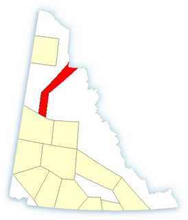
Warnings
Ft. Liard Region including Nahanni Butte - Trout Lake4:33 AM MDT Friday 16 June 2006 Rainfall warning forFt. Liard Region including Nahanni Butte - Trout Lake issued Showers at times heavy expected over the next two days.A nearly stationary disturbance extending from northwestern Alberta into the southwestern Liard Valley will continue to generate showers and a few thundershowers across the region for the next two days. 20 millimetres of rain has already fallen and another 30 to 40 is expected before Saturday morning. An additional 30 millimetres is forecast for Saturday. 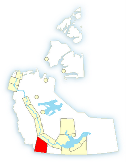
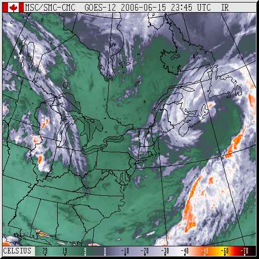
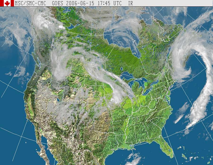
"...one of the best looking comma structures likely to be seen in the month of June."
Watches added:
Southeastern Saskatchewan, Southwestern Manitoba 11:28 AM CST Thursday 15 June 2006 Severe thunderstorm watch for Carlyle - Oxbow - Carnduff - Bienfait - Stoughton issued An approaching trough of low pressure is forecast to trigger thunderstorms today. Some of these thunderstorms may become severe.This is an alert to the potential development of severe thunderstorms with large hail and damaging winds.Monitor weather conditions..Listen for updated statements. If threatening weather approaches take immediate safety precautions.

