High Heat and Humidity Warnings for Montreal Area
0 Comments Published by CBEMN on Monday, July 31, 2006 at 3:19 PM.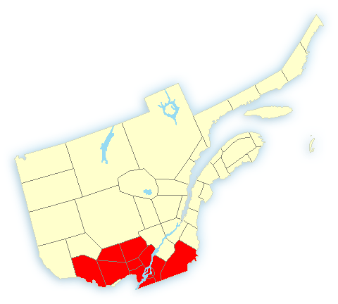
Warnings
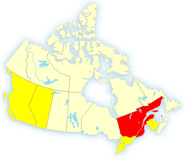
Metro Montréal - Laval3:28 PM EDT Monday 31 July 2006High heat and humidity warning forMetro Montréal - Laval issued .A warm and very humid airmass will cover southwestern Québec Tuesdaymaking conditions very uncomfortable. Thunderstorms possibly strongin the evening will make conditions more bearable.During this period, people suffering from chronic desease (E.G.:cardiovascular and respiratory) could see their condition worsen.In addition, exposure to these weather conditions could cause discomfort like muscle cramps, exhaustion and heatstroke.In order to better withstand the heat we recommend the following:drink a lot of water, reduce physical activities and seek airconditioned or shady areas. If you are concerned with your health or if you want more informationcall your CLSC info-sante hotline.

Warnings
Thompson, Thicket Portage and Pikwitonei
4:39 PM CDT Monday 31 July 2006
Tornado warning for
Thompson, Thicket Portage and Pikwitonei issued
Persons in or near this area should be on the lookout for adverse weather conditions and take necessary safety precautions. Watch for updated statements.
Please refer to the latest public forecasts for further details and continue to monitor the situation through your local radio and television stations or Weatheradio.
Split Lake and York Landing
4:34 PM CDT Monday 31 July 2006
Severe thunderstorm warning for
Split Lake and York Landing issued
At 4:30 PM, satellite imagery and lightning detectors indicate a potentially severe thunderstorm near kelsey. This storm is tracking towards the east-northeast.
A low pressure system near Flin Flon is tracking eastward across central Manitoba today. Thunderstorms have already formed, and due to the unstable airmass in place, some of these could become severe.
Watches
Thompson - Nelson House - Split Lake
4:40 PM CDT Monday 31 July 2006
Severe thunderstorm watch for
Thompson - Nelson House - Split Lake continued
Severe thunderstorms are possible over portions of central and northern Manitoba this afternoon.
This is an alert to the potential development of severe thunderstorms with large hail and damaging winds.
Monitor weather conditions..Listen for updated statements. If threatening weather approaches take immediate safety precautions.
At 4:30 PM, satellite imagery and lightning detectors indicate a potentially severe thunderstorm near kelsey. This storm is tracking towards the east-northeast.
A low pressure system near Flin Flon is tracking eastward across central Manitoba today. Thunderstorms have already formed, and due to the unstable airmass in place, some of these could become severe.
Nunavut: Wind warning for Cambridge Bay
0 Comments Published by CBEMN on Thursday, July 27, 2006 at 4:32 AM.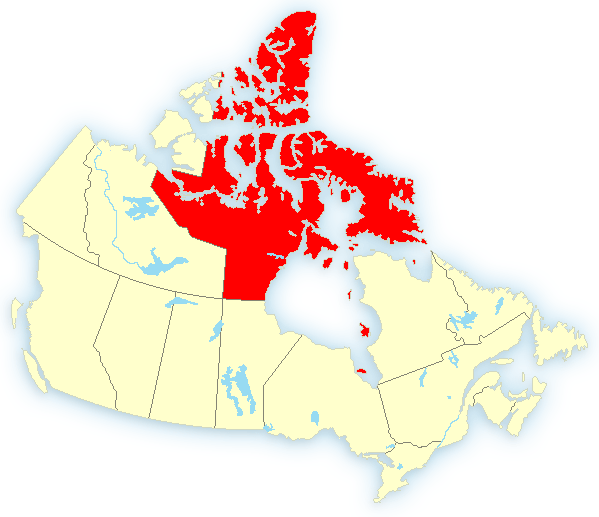
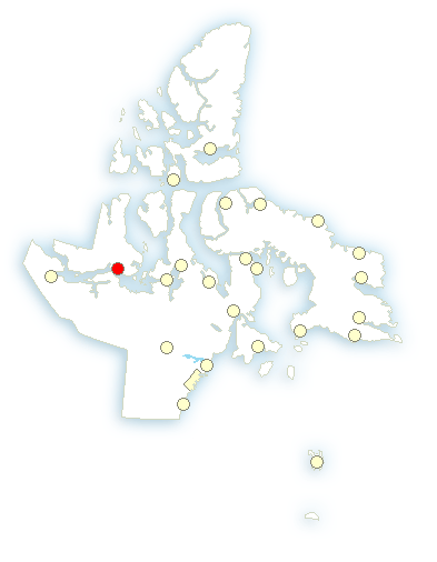

Warnings Cambridge Bay2:22 AM MDT Thursday 27 July 2006Wind warning for Cambridge Bay issued Strong north winds expected this evening.This is a warning that damaging winds are imminent or occurring in these regions. Monitor weather conditions..Listen for updated statements. A deep low pressure system near Repulse Bay will spread strong northerly winds into Cambridge Bay this evening. The winds will diminish overnight as the system weakens.
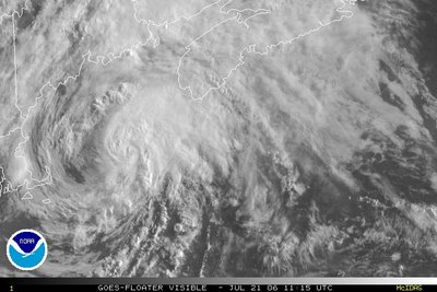
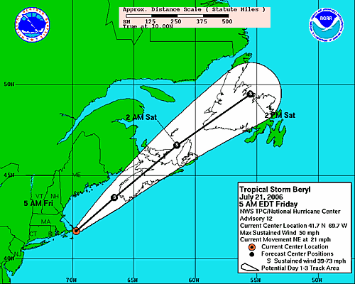
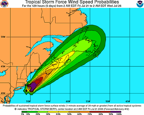
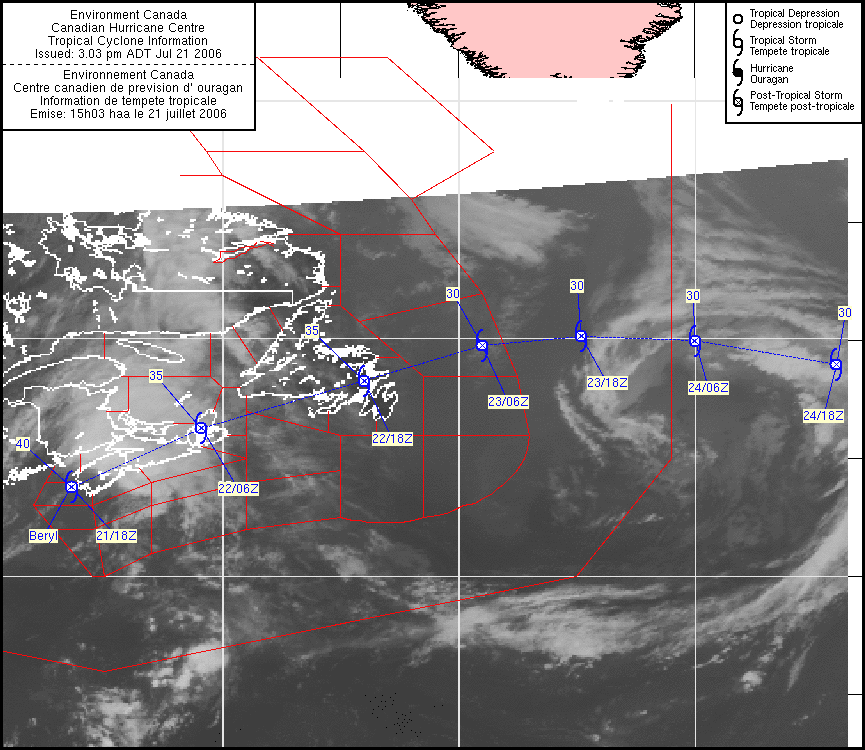
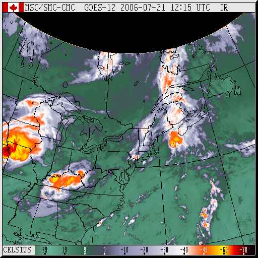
POST-TROPICAL STORM BERYL INFORMATION STATEMENT ISSUED BY THE
CANADIAN HURRICANE CENTRE OF ENVIRONMENT CANADA AT 3.00 PM ADT
FRIDAY 21 JULY 2006.
...POST-TROPICAL STORM BERYL HITTING MARITIMES...
1. CURRENT POSITION, STRENGTH, CENTRAL PRESSURE AND MOTION
AT 3.00 PM ADT... POST-TROPICAL STORM BERYL WAS LOCATED NEAR
LATITUDE 43.8 N AND LONGITUDE 66.4 W... ABOUT 10 NAUTICAL MILES
OR 25 KM WEST OF YARMOUTH . MAXIMUM SUSTAINED WINDS ARE
ESTIMATED AT 40 KNOTS... 74 KM/H... AND CENTRAL PRESSURE AT 998 MB.
BERYL IS MOVING EAST NORTHEAST AT 23 KNOTS... 43 KM/H.
2. FORECAST POSITION, CENTRAL PRESSURE AND STRENGTH
DATE TIME LAT LON MSLP MAX WIND
ADT MB KTS KMH
JUL 21 3.00 PM 43.8N 66.4W 998 40 74 POST-TROPICAL
JUL 22 3.00 AM 46.3N 60.9W 999 35 65 POST-TROPICAL
JUL 22 3.00 PM 48.3N 54.0W 1000 35 65 POST-TROPICAL
JUL 23 3.00 AM 49.8N 49.0W 1002 30 56 POST-TROPICAL
JUL 23 3.00 PM 50.2N 44.8W 1009 30 56 POST-TROPICAL
JUL 24 3.00 AM 50.0N 40.0W 1009 30 56 POST-TROPICAL
JUL 24 3.00 PM 49.0N 34.0W 1006 30 56 POST-TROPICAL
3. PUBLIC WEATHER IMPACTS AND WARNINGS SUMMARY
RAINFALL AMOUNTS TO 2PM ADT INCLUDE 59 MM AT YARMOUTH... 48 MM
AT BRIER ISLAND ... AND A LOCAL REPORT OF 45 MM FROM FREDERICTON
THIS MORNING. MAXIMUM WIND REPORTED WAS 96 KM/H AT BACCARO POINT
NOVA SCOTIA.
THE ATLANTIC STORM PREDICTION CENTRE IS MAINTAINING RAINFALL
WARNINGS AHEAD OF THE TRACK OF BERYL... NAMELY THROUGH MUCH OF
MAINLAND NOVA SCOTIA AND SOUTHERN NEW BRUNSWICK. THE BACK EDGE OF
THE HEAVY RAIN HAS REACHED WESTERN NOVA SCOTIA AND RAIN WARNINGS
WILL BE ENDED IN THOSE AREAS. AS OF FORECAST TIME THE ASPC WAS
CONSIDERING RAINFALL WARNINGS FOR PEI BUT THEY HAVE NOT YET BEEN
ISSUED. WIND WARNINGS ARE IN EFFECT FOR SHELBURNE COUNTY OF NOVA
SCOTIA WITH GUSTS TO 90 KM/H ESPECIALLY IN EXPOSED LOCATIONS.
GUSTS TO 80 KM/H ARE EXPECTED AS FAR EAST AS HALIFAX.
4. MARINE WEATHER IMPACTS AND WARNINGS SUMMARY
GALE WARNINGS ARE IN EFFECT FOR REGIONS SOUTH OF THE TRACK OF THE
LOW WITH WINDS OF 35 TO 40 KNOTS. MAXIMUM SEA STATE NEAR 5 METERS
IS EXPECTED SOUTH OF THE TRACK. MODERATELY ROUGH SURF IS EXPECTED
ALONG THE ATLANTIC COAST OF SOUTHWEST NOVA SCOTIA TONIGHT.
5. TECHNICAL DISCUSSION
A. ANALYSIS
CONVECTION HAS MAINTAINED ITSELF MOSTLY TO THE IMMEDIATE NORTHEAST
OF THE CENTRE TODAY. BERYL HAS UNDERGONE ITS POST-TROPICAL
TRANSITION EARLIER TODAY AND MAXIMUM SUSTAINED WINDS ARE ESTIMATED
AT 40 KNOTS. WINDS AT BUOY 44037 HAVE NOW BACKED TO THE NORTH AND
JUDGING BY THE WINDS AND PRESSURE FALLS OVER SOUTHWEST NOVA SCOTIA
IT NOW LOOKS LIKE THE CENTRE OF BERYL WILL BE PASSING NEAR OR JUST
WEST OF YARMOUTH IMMINENTLY.
B. PROGNOSTIC
IN LIGHT OF THE TRAJECTORY OF BERYL EARLIER TODAY OUR TRACK HAS
BEEN ADJUSTED TO THE NORTHWEST. CONSEQUENTLY POST-TROPICAL BERYL
IS NOW EXPECTED TO MOVE ACROSS THE SPINE OF NOVA SCOTIA THIS
EVENING EVENTUALLY REACHING CAPE BRETON OVERNIGHT. THIS TRACK IS
SIMILAR TO THE 06Z UKMET TRACK. LATER IN THE PERIOD THE TRACK ACROSS
NEWFOUNDLAND HAS ALSO BEEN ADJUSTED SLIGHTLY NORTH. THE REMNANTS OF
BERYL ARE EXPECTED TO MOVE ACROSS THE NORTHERN GRAND BANKS LATE
SATURDAY AND THEN MOVING EASTWARD ACROSS THE NORTH ATLANTIC.
C. PUBLIC WEATHER
ALL THE MOISTURE IS SHEARED AHEAD OF THE STORM CENTRE WITH REPORTS
SINCE THIS MORNING OF 20-30 MM PER HOUR IN SOME LOCATIONS. WITH A
TRACK FARTHER NORTH THE RAINFALL AMOUNTS ALONG THE ATLANTIC COAST
OF NOVA SCOTIA SHOULD BE LESS THAN EXPECTED EARLIER SINCE MOST OF
THAT RAIN WILL BE IN BANDS.
D. MARINE WEATHER
STEADY MARINE GALES HAVE YET TO BE REPORTED.
PREDICTED WIND RADII (NM)
TIME GALES STORMS HURRICANE
END LAFORTUNE/BOWYER

Warnings Richelieu Valley - Saint-Hyacinthe 4:21 AM EDT Sunday 16 July 2006 High heat and humidity warning forRichelieu Valley - Saint-Hyacinthe issued A warm and very humid airmass will cover these regions Monday afternoon making conditions very uncomfortable. During this period,people with chronic diseases (ex.: cardiovascular and respiratory)could see their conditions worsen. Moreover, exposure to theseconditions could cause discomfort like muscle cramps, exhaustion andheatstroke.In order to better withstand the heat we recommend the following:drink a lot of water, reduce physical activities and seek airconditioned or shady areas.

 Severe thunderstorm watches and warnings in parts of B.C., Alberta, Quebec, New Brunswick and Ontario
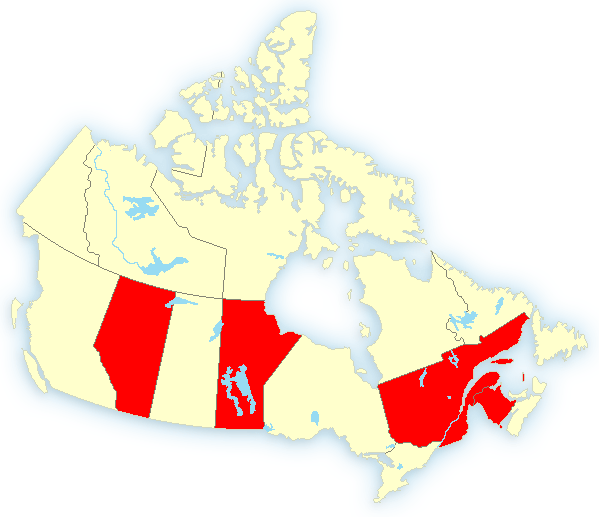 Severe Thunderstorm watches and warnings in three provinces tonight.