Another near miss for much of Nova Scotia
0 Comments Published by CBEMN on Friday, January 26, 2007 at 5:18 AM.
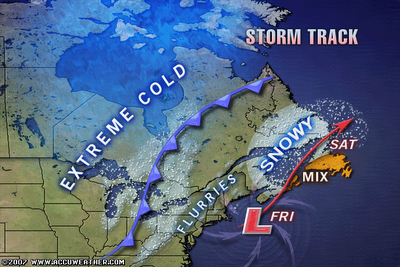
The developing large Atlantic ocean storm which was predicted over the past few days is forming a little farther to the south and east than what was initially thought, since the energy needed to form the storm was a little slower in arriving, which is allowing the storm to form a little more to the east and southeast before the turn toward the north. The latest pressure falls, which usually dictate where the storm is headed, are indicating that the storm will end up having a much greater impact on Newfoundland compared to the Maritimes Friday afternoon and into Saturday. It looks like much of Nova Scotia and PEI will escape a major snowstorm. The exception will still be Cape Breton Island where there will still be blizzard conditions late Friday and Friday night. It also looks like the storm will stay fairly compact, instead of splitting, so a major snowfall and blizzard is in the works for the western half of Newfoundland.
Snow storm coming this Friday
0 Comments Published by CBEMN on Wednesday, January 24, 2007 at 4:00 PM.
Snow arrives Friday morning then snow, heavy at times through a good part of Friday night. Possible blizzard conditions Friday afternoon and evening. This will be a cold storm, so the snow to liquid ratios will be higher than normal, meaning you do not need as much liquid equivalent to make a certain amount of snow. Sustained winds averaging 55-65 kph with gusts to 90-95 kph. Total snowfall 12-25 cm.
January 14-16 winter snowfall forecast
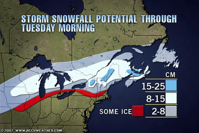
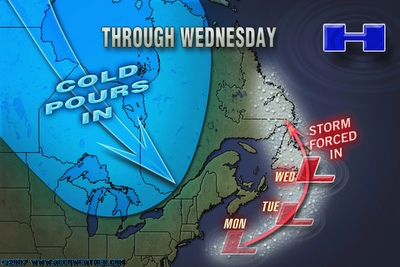
0 Comments Published by CBEMN on Sunday, January 14, 2007 at 12:02 PM. Winter storm warning has been issued for Halifax. Two systems are converging on us. As of Sunday afternoon, the snow is rather heavy, but will subside through tomorrow morning. By tomorrow afternoon, the second system will be coming through, bring snow and ice pellets. Get home tomorrow before the really bad weather hits!


